Get In Gear
A letterbox with 4 bonus boxes.
The recently built Hominy Creek
Trail... (I won't say recently completed because there's still work
going on around it...) is a nice addition to the area. It
provides a pleasant way to bike from the area where I live into town
without spending so much time on narrow busy roads. It's a
nice paved path suitable for walking or rolling. This series
of boxes is perfect for a family on foot or on bikes or anyone who
wants a quick, relatively easy hunt. Only the first box is
much off the path... The rest are all pretty easy to reach.
That said, be super careful about others watching since I
don't doubt that this will be a well-used trail!
So hop on your bike and get in gear!
(It can be an imaginary bike... the section of trail this covers is
less than a mile long.)
You can start your hunt from either
end of the trail. None of the boxes are north of St. Charles
Rd. Only the main box "Bicycle and Rider" has a logbook; the
"bonus" boxes just have stamps.
Starting from where the trail meets St.
Charles Rd:
Head along the trail as it wanders
generally to the southwest. As it heads more into the wooded
area, you'll reach a sharp left turn and a bridge over the creek.
You'll find yourself facing a large retaining wall.
The wall has stepped capstones as it ascends. (Fig 1a.)
Carefully head up to the 13th capstone. Head 30
paces (two steps each... may be awkward on the slope) at 60 degrees.
Spot a large rock at the base of an oak with a piece of pipe
near it. (Fig 1b.) Here you'll find your Bike and
Rider (main box with logbook).
Continue along the path until you
reach the end of the retaining wall. Stand at the end of the
wall and face 250 degrees so you are looking at a tree with a triple
trunk... a walnut I think. (Fig 2a.) Get some relief from the
bright sun by finding the SPOR at the base of the tree.
Return to the path and continue
following it. You will go under Broadway. Continue
along a more open area on the left, passing a hill where an old
abandoned road ends (may be hard to see from down here).
Continue on until you see a large cluster of trees on your
left near a small gully that crosses the path. Look for a
triple-trunked tree... a sycamore I believe. (Fig 3a.)
If you need to tighten up your bike's brake calipers or
adjust the handlebar, you'll find a handy tool in a SPOR behind the
tree.
Continue along the trail heading
under Highway 63. The first span has steel girder supports to
your left. Rehydrate by looking for a SPOR at the base of the
left-most leg of the structure.
Hopefully your tires are properly
inflated, otherwise you'll need to continue on to the end of the trail
where it runs out and Green Valley Drive begins. Near the end
of the path, you'll see three large rocks. The farthest one
from the trail is near a gas line marker. (Fig 5a.) Examine
this rock for some air.
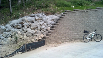
Fig 1a. |
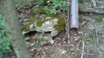
Fig 1b. |
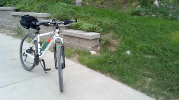
Fig 2a. |
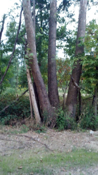
Fig 3a. |
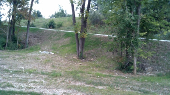
Fig 2b. |
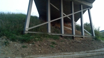
Fig 4a. |
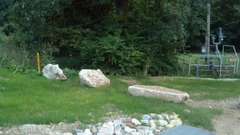
Fig 5a. |
Starting from Green Valley Drive:
At the beginning of the trail, spot
three large rocks and a gas line marker to your right. (Fig
5a.) Examine the rock farthest from the trail to put some air
in your tires.
Follow the trail heading under
Highway 63 until you are under the forth span. To your right
will be steel bridge supports. (Fig 4a.) Seek hydration by
looking for a SPOR at the base of the left-most leg of the structure.
Continue along the trail until you
see a large-ish cluster of trees with a triple-trunked tree... a
sycamore I believe. (Fig 3a.) If you need to tighten
up your bike's brake calipers or
adjust the handlebar, you'll find a handy tool in a SPOR behind the
tree.
Continue along the path, passing a
mound on the right where an old road ends. Keep going until
you get to Broadway above you. Keep going until you reach a
path that heads up to Broadway to the right of the main path.
Between this path and the main path will be a cluster of
trees. One tree there has a triple trunk... a walnut I think.
(Fig 2a.) Get some relief from the bright sun by finding the
SPOR at the base of the tree.
Return to the main path and follow
along the large retaining wall on your right that ends near a bridge
over the creek. At the end near the bridge it has stepped capstones as
it ascends. (Fig 1a.) Carefully head
up to the 13th capstone. Head 30 paces (two steps each... may
be
awkward on the slope) at 60 degrees. Spot a large rock at the
base of
an oak with a piece of pipe near it. (Fig 1b.) Here
you'll find your
Bike and Rider (main box with logbook).


